top of page


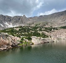
Trail description: Start this hike from the Emmaline Lake/ Mummy Pass Trailhead up the road from the Tom Bennett Campground (FS road 145). The trail is a challenging hike 5.7 miles one way with about 900 ft of elevation gain. There are 11 Stream Tracker sites along this trail. The trail takes you to Cirque Meadows and then up to Cirque Lake and Emmaline Lake. The Stream Tracker sites stop short of the final stretch of trail to the lakes. Prior to hiking the trail, download the Anecdata.org mobile app to your phone when you have Wi-fi or cell service, create an account, then search and join Stream Tracker. Before hiking the trail, familiarize yourself with how to navigate to a hotspot and how to log an observation.
Distance: 10.4 mile out-and-back
Difficulty: Hard
Stream Tracker hotspots: 11
Volunteers needed: July 1 - October 1 2023

Map of Stream Tracker hotspots- click map to enlarge
bottom of page